Tuesday, March 31, 2020

MONITORING CORONAVIRUS!!!

MONITORING CORONAVIRUS!!!


Dear friends, as maybe a lot of you are currently staying home, I kindly ask you to fill this very short questionnaire following, by clicking at the link, or at the image below, so as to provide the spatial information of all (with symptoms and non-symptoms), in order to help experts organise better and faster their activities against CoVid-19 at global scale !!!


WE HAVE TO ACT NOW !!!


STEP 1: First, get informed about this specific application by clicking at the link below, and see the details by scrolling down the page:


STEP 2: Afterwards click on "Report your Symptoms" button at the upper part of the web page (or click on the image below), so as to get into the platform.


STOP CORONA Virus!!!


This solution is a joint effort of organizations and individuals across the globe:

GIS Cloud (Croatia), Smart Cloud (Croatia), Geovisual (Croatia), Jurica Kovač (Croatia), Nubigroup Geoservices & Research (Greece), Pacific Spatial Solutions Inc. (Japan), 99Geo (Brazil), Teramaps (Chile), Aquasave (North Macedonia), Hydrocontrol (Bosnia and Herzegovina), Serbian GIS Association (Serbia), North 4Smart Apps (Jordan), Sprinter Consulting (Kenya), Aleksandar Lazarević (Slovenia), Alexandru Aldea (Romania), Alin Anchidin (Romania), Antonija Živković (Croatia), Dr. Dejan Lazarević (Italy), Prof. Asoc. Enkelejda Gjinali (Albania), Eva Vuksanović Kovač (Croatia), Lajtai Bálint (Hungary), Lara Kralj (Croatia), Marko Kosanović (Germany), Mirna Čužić (Croatia), Nikola Devčić (Croatia), Nikolina and Dan (Sweden), Pierre Henry and Paulina (Poland), Tomáš Sucháček (Czech Republic).

Many congratulations from all of us !!!

Dr. Avraam Mavridis

Tuesday, February 19, 2019

Smart Farming project

Developing digital and geospatial technologies in the agrigultural sector requires intuitive support and guidement on knowledge issues, properly provided to students and to any other individual/end-user related with Smart/Digital Agriculture.

                              Smart Farming

SMART FARMING project succeeds in merging all these issues together becoming a pioneering project on Smart/Digital Technologies in Agro-environmental Management.

Website of SMART FARMING of the project: https://erasmusplus-smart-farming.eu/

Thursday, December 27, 2018

ArcGis Ideas

GeoNet is where the Esri Community - customers, Esri Staff, distributors and others in the GIS and geospatial professional community- connect, collaborate and share experiences. 
See how you can get connected with Ideas related with ArcGIS and the Geocommunity, by clicking here.


 ArcGIS Ideas

Friday, August 3, 2018

28 funded PhD positions !!!

28 funded PhD positions within the Doctoral Programme, TALENT will be provided at the Faculty of Science, University of Copenhagen in multiple scientific fields related with the environment, sustainability and more!

The deadline for applications is on 1st October 2018, 23:59 GMT +2.

More information on the scientific fields, you can find by clicking here,

and of course, more information and steps about this opportunity, you can find by visiting the University's website: https://candidate.hr-manager.net/ApplicationInit.aspx?cid=1307&ProjectId=147557&DepartmentId=18971&MediaId=4636

Wednesday, July 11, 2018

Quick Ideas For Inexpensive Green Living

Thanks to the kind contribution of  CouponChief.com, on the page "Green & Geospatial Ideas", there is a set of ideas to quickly adopt and apply easily in your everyday life, so as to contribute to the conservation of environmental resources!

Thank you very much CouponChief.com!

Wednesday, March 21, 2018

ΣΥΝΔΕΣΜΟΙ ΓΙΑ ΧΑΡΤΕΣ ΓΙΑ ΤΟ ΔΗΜΟΤΙΚΟ (in English: MAP LINKS FOR ELEMENTARY SCHOOL)

ΣΥΝΔΕΣΜΟΙ ΓΙΑ ΧΑΡΤΕΣ 
ΓΙΑ ΤΟ 1ο ΔΗΜΟΤΙΚΟ ΣΧΟΛΕΙΟ 
ΝΕΑΠΟΛΗΣ ΘΕΣΣΑΛΟΝΙΚΗΣ - ΤΑΞΗ Γ1΄ 
               
MAP LINKS FOR 1st ELEMENTARY SCHOOL of NEAPOLIS THESSALONIKI - CLASS C1' 


1ο Δημοτικό Σχολείο Νεάπολης

Όλο το υλικό και οι βοηθητικές ιστοσελίδες είναι σε καθεστώς αναβάθμισης για την νέα σχολική χρονιά...

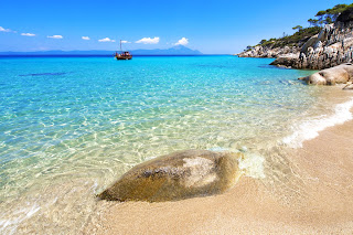
...εξερευνώντας τις Ελληνικές παραλίες..., ρίξτε μια ματιά...και βουτιά, αν θέλετε...


Καλό Καλοκαίρι !!! 
 Ανακαλύψτε τις Ελληνικές Παραλίες!!!


⛱      ⛱      ⛱
All the material and ancillary websites are upgraded for the new school year...


... exploring the Greek beaches ..., take a look ... and take a dive, if you want ...

Have a Happy Summer !!!
Discover the beaches of Greece!!!
🏖

Tuesday, February 13, 2018

3D GIS for Cultural Heritage Restoration


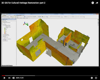
The integrated combination of digital technologies, such as laser scanning, photogrammetry, computer vision-based techniques and 3D geographic information systems (3D GIS), could exponentially increase the effectiveness of conservation strategies of ancient buildings. 
At the article of the Journal of Cultural Heritage (Volume 18, March–April 2016) : "3D GIS for cultural heritage restoration: A ‘white box’ workflow", the authors Danilo Marco Campanaro, Giacomo Landeschi, Nicoló Dell’Unto and Anne-Marie Leander Touati, provide this perspective. A set of three (3) videos in Youtube promote this method free to the public. The videos are following: 
                                                                          Part 1 
 3D GIS for Cultural Heritage Restoration- part 1
         
                                                                            Part 2 
 3D GIS for Cultural Heritage Restoration- part 2

Part 3 
 3D GIS for Cultural Heritage Restoration- part 3