Wednesday, March 21, 2018

ΣΥΝΔΕΣΜΟΙ ΓΙΑ ΧΑΡΤΕΣ ΓΙΑ ΤΟ ΔΗΜΟΤΙΚΟ (in English: MAP LINKS FOR ELEMENTARY SCHOOL)

ΣΥΝΔΕΣΜΟΙ ΓΙΑ ΧΑΡΤΕΣ 
ΓΙΑ ΤΟ 1ο ΔΗΜΟΤΙΚΟ ΣΧΟΛΕΙΟ 
ΝΕΑΠΟΛΗΣ ΘΕΣΣΑΛΟΝΙΚΗΣ - ΤΑΞΗ Γ1΄ 
               
MAP LINKS FOR 1st ELEMENTARY SCHOOL of NEAPOLIS THESSALONIKI - CLASS C1' 


1ο Δημοτικό Σχολείο Νεάπολης

Όλο το υλικό και οι βοηθητικές ιστοσελίδες είναι σε καθεστώς αναβάθμισης για την νέα σχολική χρονιά...

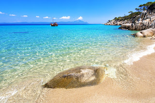
...εξερευνώντας τις Ελληνικές παραλίες..., ρίξτε μια ματιά...και βουτιά, αν θέλετε...


Καλό Καλοκαίρι !!! 
 Ανακαλύψτε τις Ελληνικές Παραλίες!!!


⛱      ⛱      ⛱
All the material and ancillary websites are upgraded for the new school year...


... exploring the Greek beaches ..., take a look ... and take a dive, if you want ...

Have a Happy Summer !!!
Discover the beaches of Greece!!!
🏖

Tuesday, February 13, 2018

3D GIS for Cultural Heritage Restoration


The integrated combination of digital technologies, such as laser scanning, photogrammetry, computer vision-based techniques and 3D geographic information systems (3D GIS), could exponentially increase the effectiveness of conservation strategies of ancient buildings. 
At the article of the Journal of Cultural Heritage (Volume 18, March–April 2016) : "3D GIS for cultural heritage restoration: A ‘white box’ workflow", the authors Danilo Marco Campanaro, Giacomo Landeschi, Nicoló Dell’Unto and Anne-Marie Leander Touati, provide this perspective. A set of three (3) videos in Youtube promote this method free to the public. The videos are following: 
                                                                          Part 1 
 3D GIS for Cultural Heritage Restoration- part 1
         
                                                                            Part 2 
 3D GIS for Cultural Heritage Restoration- part 2

Part 3 
 3D GIS for Cultural Heritage Restoration- part 3


Friday, January 19, 2018

Three PhD positions in Soil Science at SLU, Sweden

Currently, there are three available PhD positions in soil science available at SLU, Sweden. 
They involve precision agriculture, plant nutrition, proximal and remote sensing, pedometrics, digital soil and crop mapping, etc.
You can read more by clicking here.

Wednesday, January 10, 2018

A New Page is Added !!! GEOSPATIAL RELATED PROJECTS !!!

A new page is added  at GISBIOENVINET called:  GEOSPATIAL RELATED PROJECTS
This page will act as an active contributor to sharing and dissemination of Geospatial Related Projects from European Union, U.S. National Science Foundation and other organizations.

For the beginning, there is an ERASMUS+ KA2 project called SMART FARMING, where I participate in as Senior Researcher.

 SMART FARMING project

 It is my privilege to be a member of this important project and consortium.

You can find more information by clicking here:  GEOSPATIAL RELATED PROJECTS


Dr. Avraam Mavridis

Wednesday, November 22, 2017

Plant a tree (...with just 1 click!)

(The following information comes from a link of European Investment Bank : http://www.eib.org/infocentre/forms/formcab) 
Plant a tree (...with just 1 click!)

The European Investment Bank pioneered the Green Bond market with its first Climate Awareness Bond in July 2007. To mark the 10th anniversary of this milestone, the EIB has partnered with NGO WeForest in a project to make the planet greener – an additional way for us to contribute to the fight against global warming through reducing the levels of carbon dioxide in the atmosphere.

How does it work?

For every person submitting the form, the EIB will plant a tree in Ethiopia or India, two countries with a huge potential for forest restauration, with the help of WeForest.
The project will start in the second half of 2017 and will be carried out over several months. Information on project advancement will be made available on the EIB website here.
Get registered and help EIB and WeForest to plant a tree!

Thursday, August 3, 2017

Videos tutorials on Open Source GIS

An open source application, by definition, is software that you can freely access and modify the source code for [1]. Open source GIS programs like QGIS  (otherwise known as Quantum GIS), have succeeded in overcoming restraints of the first years and with the help of the international, scientific community, they show remarkable results in elaboration and efficiency of geodata analysis and beyond, through several geospatial modules and projects.
Self tutorial approaches on these projects can be done through manuals. However, a significant contribution and evolution in self-learning/free-learning is the provision of several videos tutorials (as we've approached in other posts in 2012 and 2014) on Open Source GIS programs, freely available to the public by TutorielGeo, through youtube.

 Tutorielgeo website


A more systematic approach on this method can be exploited in many ways: by schools, by academics and universities, by governments, by privates, by students, by simple end-users and much more, so as to develop spatial skills and awareness to the public to enhance their activities, providing further benefits to the society.

Tuesday, April 18, 2017

NASA Europa Challenge 2017

This post contributes to the announcement of Dr. Suchith Anand as regards the launch of the SMARTIES Entrepreneurship competition [1],[2] through the NASA Europa Challenge 2017 [3],[4]. 
SMARTIES will provide 5000 GBP for awards (£2500 for First Place, £1500 for the Second Place and £1000 for the Third Place). Due to the nature of the funding, the SMARTIES Entrepreneurship awards are specific to all UK and India students who participate in the NASA Europa Challenge 2017. 
This is a contest where everyone wins just by playing!  
Help your city and thereby the cities of the world with capabilities all cities need. We are in this world together, let’s deliver results ‘for the benefit of all’, the NASA motto. 


We look forward to work with you to create a world that is more accessible, equitable and full of innovation and opportunities for everyone.

Best wishes,

Suchith

Dr. Suchith Anand


##########################


##########################

With my wishes for best of success,

Dr. Avraam Mavridis